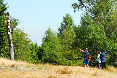
Hiking trails in the area of Leskowiec Mountain and John Paul II Mountain (Groń Jana Pawła II)
GOPR Beskidy
Rescue numbers in the mountains:
- 985
- 601 100 300
Red: Krzeszów Górny - Harańczykowa Mountain - Gron of John Paul II - 2 hours.
The trail leads from Krzeszów Górny on Gron of John Paul II. The route leads through Harańczykowa Mountain, where ridge there are two stone shrines of the Virgin Mary. From the top you can enjoy beautiful views especially on Żurawnica and around Pewelski Range in Middle Beskids (Beskid Średni). Into the trail there is located mountain hut (PTTK) just below Groniem John Paul II (890 m a.s.l.), where is located the biggest hub routes in the Little Beskids (Beskid Mały).
Blue: Ponikiew - Gron of John Paul II - 1.45 pm.
The trail was named Czeslaw Panczakiewicza. It leads through the valley of the stream Ponikiewka and uniformly higher up the dense forest.
Between Gancarz Mountain and Gron John Paul II (890 m a.s.l.) trail connects with the green one leading from Andrychów. These trails lead to the summit together Gron of John Paul II and the chapel, and then converge down to the shelter PTTK.
Blue: Tarnawa Górna - Makowska Mountain - Gron of John Paul II - 1.30 pm. From Tarnawa Górna trail goes to Makowska Mountain. At the top on the right side of the reach and end with black marks leading from Śleszowice. The trail leads to the PTTK shelter near the papal chapel.
Black: Rzyki Jagódki - Gron of John Paul II - 1 hour.
This is the shortest access to the shelter PTTK and the chapel on Gron of John Paul II (890 m a.s.l.). Course of the route overlaps with the tourist downhill skiing to Rzyki Jagódki, as well as the pilgrimage route "White Hearts," which leads to the chapel on Gron of John Paul II. The approach from Rzyki Jagódki is steep, the terrain is almost entirely wooded.
Hiking trails in the area of Łysa Mountain and Ostry Wierch Mountain
Blue: Wadowice - Czesław Panczakiewicz Pass of Łysa Mountain - Ponikiew - 2 hours.
The trail connects the center of Wadowice with Ponikiew leads in most of the outdoor area. Before Ponikiew over the ridge Łysa Mountain (554 m a.s.l.) and the Bliźniaki Mountain (564 m a.s.l.) by Panczakiewicz Pass. It is a long foothill of a ridge from the valley Skawa River in the east to the valley stream Choczenka from the West. After descending the blue trail to Ponikiew it reaches the local road leading to the valley Skawa (Czartak) and from the highway Wadowice - Sucha Beskidzka.
Yellow: Gorzeń Górny - Iłowiec - Łysa Mountain – Bliźniaki Mountains - Kaczyna - 3 hours.
The route starts from Gorzeń Górny and museum of Emil Zegadłowicz.
Above the museum joins black trail leading from Wadowice to Czartak. Both of these routes lead to the slope of Iłowiec Mountain, and yellow leads exactly to the top of Iłowiec Mountain (472 m a.s.l.)and black turns to Czartak. Next yellow trail runs through Łysa Mountain (554 m a.s.l.), Panczakiewicz Pass, Bliźniaki (564 m a.s.l.). For the Bliźniaki steep trail descends in a crucial stretch of the valley of the stream of Choczenka until Kaczyny.
Black: Wadowice - Goryczkowiec - Gorzeń Górny - Czartak - 1.45 pm.
The trail is a connection of the center of Wadowice to the valley Skawa in the area of future dam and reservoir "Świnna Poreba." It runs through town buildings, then we encounter the first interesting Gorczykowiec hill (375 m a.s.l.), which is also called the bell of the brick chapel of the eighteenth century with the so-called ‘Against storm Loreta bell’. The trail leads through Iłowiec Hill bringing to Czartak village at the outlet of stream Ponikiewka to Skawa and near the highway from Wadowice to Sucha Beskidzka.
Hiking trails in the area Jaroszowickiej Mountain
Yellow: Klecza Górna - Jaroszowicka Mountain – Gorzeń Górny - 2.15 pm.
It is the only trail in the introductory Beskid Mały from Krakow - Cieszyn east of Wadowice. Densely forested massif Jaroszowicka Mountain (541 m a.s.l.) makes a certain monotony of the journey dashed, however, at Klecza Górna and Gorzeń Górny by pretty landscape. In Klecza trail leads past a brick, one-story palace from 1883. The trail ends in Gorzeń Górny at the manor of Emil Zegadłowicz.
Black: Czartak - Jaroszowicka Mountain - Łękawica - 2.15 pm.
The trail from the valley Skawa and from the highway Wadowice - Sucha Beskidzka, goes briefly to steady forest Jaroszowicka Mount (541 m a.s.l.) and further leads to Łękawica. The trail connects the Beskid Mały with Beskid Średni (ie. Jaroszowicka Mount with Żar Peak over Kalwaria Zebrzydowska).
The above-described routes can be viewed on the website Tourist Routes Malopolska